Quantitative courses in the College of the Environment focus on examples from the physical world and from the living natural world, including conservation at landscape scale and impacts of global change. We teach the basics of math, stats, coding and mapping, through to advanced coursework in modeling, computation and remote sensing. Our courses prepare students to engage in actionable science in support of a sustainable, biodiverse world.
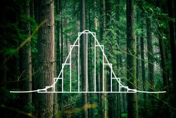 The Basics – Math and Stat Skills
For students just starting out in calculus and statistics, these courses provide natural world examples to learn from.
Math and Statistics Courses
Q SCI 291: Calculus For Natural Systems I: Derivatives
Introduction to differential calculus, emphasizing development of basic skills. Examples promote understanding of mathematics and applications to modeling and solving biological problems. Topics include optimization and curve analysis. Cannot be taken for credit if student received a minimum grade of 2.0 or above in MATH 124 (or equivalent).
- Autumn, Winter
- 5 credits (NSc, RSN)
- Prerequisites: Either MATH 120, Q SCI 190, a minimum score of 2 on the AP MATH test (AB or BC).
- Faculty: Steve Scherba
Q SCI 292: Calculus For Natural Systems II: Integrals
Introduction to integral calculus, emphasizing development of basic skills. Examples promote understanding of mathematics and applications to modeling and solving biological problems. Topics include areas under curves, volumes, and differential equations. Cannot be taken for credit if student received a minimum grade of 2.0 or above in MATH 125 (or equivalent).
- Winter, Spring
- 5 credits (NSc, RSN)
- Prerequisites: Either MATH 124, Q SCI 391, or a minimum score of 3 on the AP MATH test (AB or BC).
- Faculty: Andrew Berdahl, Steve Scherba
Q SCI 381 Introduction to Probability and Statistics
Applications to biological and natural resource problems stressing the formulation and interpretation of statistical tests. Random variables, expectations, variances, binomial, hypergeometric, Poisson, normal, chi-square, “t” and “F” distributions.
- Autumn, Winter, Spring
- 5 credits (NSc, RSN)
- Prerequisites: Either MATH 120, MATH 124, MATH 125, MATH 126, Q SCI 190, or Q SCI 291, or a minimum score of 2 on the AP MATH test (AB or BC).
- Faculty: John Horne, Tim Jones, Patrick Tobin, Manjaree Binjolkar
ENVIR 310 Data Analysis in Environmental Studies
Practical data-analysis workshop that introduces analysis of quantitative and qualitative data from social and environmental topics. Students use public data or research data to develop skills in data organization, visualization, and statistics. Students evaluate the use of socio-environmental data in graphics and learn to use data to make informed decisions. Quantitative methods, qualitative analysis, and survey analysis are introduced.
- Spring, Summer
- 5 credits (NSc, RSN)
- Prerequisites: None
- Faculty: Yen-Chu Weng
 Programming, Coding and Data Analysis
These courses focus on data science: manipulating data in programming languages, including Python and R.
Programming and Data Courses
FISH 274 Introduction to Data Analysis for Aquatic Sciences
Basic knowledge of data acquisition, manipulation, and visualization are necessary for conducting biological research. Students will be introduced to bash, R, and Jupyter Notebooks, but the concepts learned will easily apply to other computational work. By the end of this course students will be able to import data into R, perform analysis on that data, and export the results to graphs, and presentations.
- Autumn
- 3 credits
- Prerequisites: BIOL 180
- Faculty: Steven Roberts
OCEAN 215 Methods of Oceanographic Data Analysis
Statistics, graphical representations, and analysis methods for oceanographic datasets using the PYTHON programming language.
- Autumn
- 4 credits
- Prerequisites: MATH 125
- Faculty: Stephen Riser
ATM S 310 Programming for Atmospheric Data Analysis
Introduces students to data analysis in the atmospheric sciences using modern programming languages and techniques. Provides hands-on experience through the exploration of atmospheric datasets.
- Autumn
- 4 credits (NSc)
- Prerequisites: None
- Faculty: Alexandra Anderson-Frey
 Advanced Statistics and Ecological Modeling
For advanced students wishing to continue exploring multivariate statistics and computational models in ecology and conservation.
Advanced Statistics and Ecological Modeling Courses
Q SCI 482 Statistical Inference in Applied Research I: Hypothesis Testing and Estimation for Ecologists and Resource Managers
Theory and application of foundational statistical tests such as chi-square tests, t-tests, analysis of variance; parametric and non-parametric tests; estimating statistical power and sample size needed for experiments. Use of computer programming in R to apply standard statistical tests to solve biological problems.
- Autumn, Winter
- 5 credits (NSc)
- Prerequisites: Either STAT 311 or Q SCI 381.
- Faculty: Trevor Branch, Indroneil Ganguly
Q SCI 483 Statistical Inference in Applied Research II: Regression Analysis for Ecologists and Resource Managers
Analysis of linear regression models and introduction to nonlinear models. Model selection using generalized F-tests; residual analysis. Application to categorical, count, binomial, transformed variables. Introduction to matrix formation of regression models and applications.
- Spring
- 5 credits (NSc)
- Prerequisites: Q SCI 482
- Faculty: Tim Jones
Q SCI / FISH 454 Introduction to Quantitative Ecology
Examines concepts in quantitative ecology ranging from model development, interpretation, and fitting model to data. Develops skills to implement quantitative models in spreadsheets and R software.
- Winter
- 5 credits (NSc)
- Prerequisites: None
- Faculty: Tim Essington
Q SCI / FISH 458 Advanced Ecological Modeling: Applying Ecological Models to Manage and Conserve Natural Resources
Models of fish and wildlife population abundance, including age-structured models, the interaction between human exploitation and protected areas, calculating extinction risk, and examining the effect of alternative management strategies on natural populations. A core part of the course is fitting models to data using both maximum likelihood and Bayesian approaches, and increasing the programming abilities of students by implementing models in R.
- Spring
- 5 credits (NSc)
- Prerequisites: None
- Faculty: Trevor Branch
Q SCI / ESRM 451 Analytical Methods in Wildlife Science
This course provides a foundation of techniques commonly used by wildlife biologists in data collection and analysis. Predominantly focused on parameter estimation of demographic rates of animal populations. This course will explore, and discuss in detail, quantitative methods needed to address conservation and management problems in the real world.
- Winter
- 5 credits (NSc)
- Prerequisites: ESRM 351 and Q SCI 482.
- Faculty: Taylor Ganz
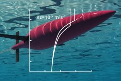 Instrumentation and Technology
These courses are perfect for students wanting hands-on experience building and deploying data collection sensors and understanding the basics of data analysis.
Instrumentation and Technology Courses
OCEAN 161 Introduction to Environmental Monitoring and Technology
Introduces a range of environmental monitoring technologies in the context of their scientific application and case studies spanning ocean, atmosphere, and land examples. Includes hands-on experience with sensors and working with data from various technologies and monitoring techniques. Integrates knowledge across environmental science, technology, and engineering.
- Autumn
- 5 credits (NSc)
- Prerequisites: None
- Faculty: Sasha Seroy
OCEAN 261 Introduction to Ocean Technology
Introduces ocean science and technology in observational ocean science. Covers the basics of underwater sensor design, power, and data communication, and introduces the design and build process and the operational scope of the ERIS cabled observatory.
- Spring
- 2 credits (NSc)
- Prerequisites: None
- Faculty: Rick Rupan, Sasha Seroy, Fritz Stahr
OCEAN 351 Foundations of Ocean Sensors
Experiential learning giving students foundational knowledge of methods used to observe key quantities that characterize marine environments. Includes theory and application of sensor design and construction principles, in the context of inferences and hypothesis-testing about key physical, biological, chemical, and geological dynamics in the oceans.
- Winter
- 3 credits (NSc, RSN)
- Prerequisites: OCEAN 215, OCEAN 285
- Faculty: Sasha Seroy
OCEAN 361 Ocean Technology I: Introduction to Underwater Observational Sensor Design and Build
Combines ocean science and technology in a design and build course utilizing the ERIS cabled observatory at the UW Oceanography dock. Students apply the basics of sensor design, power, and data communication to individual underwater observatory projects. Prerequisite: OCEAN 261, which may be taken concurrently.
- Spring
- 2 credits (NSc)
- Prerequisites: OCEAN 261, may be taken concurrently
- Faculty: Rick Rupan, Sasha Seroy, Fritz Stahr
OCEAN 461 Advanced Ocean Technology – Project Design and Management
Project management practicum in the design, build, operations, and management of observational ocean science technology. Students oversee and mentor ongoing design and build projects, with attention to design criteria and deployment timelines.
- Spring
- 2 credits (NSc)
- Prerequisites: OCEAN 361
- Faculty: Rick Rupan, Sasha Seroy, Fritz Stahr
ATM S 451 Instruments and Observations
Principles of operating instruments for measuring important atmospheric parameters (e.g., temperature, humidity, aerosol concentration). Concepts of sensitivity, accuracy, representativeness, time response. Manipulation of output data including signal processing and statistical analysis. Experimental design and implementation of the design in actual field experiments is included.
- Winter
- 5 credits (NSc)
- Prerequisites: ATM S 370; either STAT/MATH 390 or Q SCI 381
- Faculty: Alexandra Anderson-Frey, Becky Alexander
 GIS and Remote Sensing
From introductory to advanced, these courses focus on satellite-based data collection (remote sensing) and data mapping and geostatistics (GIS).
GIS and Remote Sensing Courses
ESRM 250 Introduction to Geographic Information Systems in Forest Resources
Applications of GIS technology to forest science and management. Fundamentals of GIS systems: data sources, preprocessing, map analysis, output; remote sensing as a source of GIS data, image analysis, and classification. Emphasis on GIS as a source of management and technical information requests.
- Autumn, Winter, Spring, Summer
- 5 credits (NSc, RSN)
- Prerequisites: None
- Faculty: Varies
ESS 401 Field Geology with GIS
Geologic mapping in a variety of rock types in the Western United States coupled with and augmented through geospatial analyses. Enhances students’ knowledge of geologic phenomena and processes. Development of skills in mapping, field interpretation, GIS/remote sensing analysis, and report writing. Students responsible for own living expenses while in the field.
- Summer
- 12 credits (NSc)
- Prerequisites: ESS 211; ESS 212; ESS 213; ESS 420; and either ESS 311, ESS 312, ESS 313, ESS 314, or ESS 316
- Faculty: Steven Walters (co-instructors vary)
ESS 420 Introduction to Geographic Information Systems for the Earth Sciences
Examines principles of GISA applied to the geological sciences. Covers basics of GIScience, data types, and GIS analyses. Includes hands-on analysis applied to geologic patterns and phenomena: sources geological data; geological mapping; measures of topography; hydrologic flow patterns; and topics of the students’ own interests.
- Autumn, Spring
- 5 credits
- Prerequisites: None
- Faculty: Steven Walters
ESRM 190 Digital Earth
Focuses on developing remote sensing literacy through addressing large scale problems by using big data from global to local levels across a full spectrum of environmental applications. Knowledge and skills developed in this course can be taken and applied to many fields.
- Autumn
- 5 credits
- Prerequisites: None
- Faculty: Monika Moskal
This is a special topics course. Ask your advisor for more information.
ESRM 430 Remote Sensing of the Environment
Focuses on hyperspatial remote sensing fundamentals, interpretation and manipulation of aerial photography, satellite imagery, and Light Detection and Ranging (LiDAR). Uses traditional and ‘state of the art’ image processing techniques. Students learn to evaluate available hyperspatial remote sensing data sources and design simple projects related to environmental applications.
- Autumn
- 5 credits (NSc)
- Prerequisites: None
- Faculty: Monika Moskal
ESRM / CEE 432 Advanced Remote Sensing and Earth Observation
Covers the theory and application of satellite remote sensing as a tool for environmental science. Topics include the fundamentals of electromagnetic radiation, reflection and absorption, black body radiation, use of the Plank Function, satellite and sensor technology, map projections, integration of GIS data, and digital image analysis. Practical training with advanced image processing software (ENVI and open source). Recommended: GIS; statistics; and basic physics.
- Winter
- 4 credits (NSc, RSN)
- Prerequisites: None
- Faculty: David Butman
ESS 421 Introduction to Geological Remote Sensing
Principles of image interpretation for geologists. Study of land forms, structure, lithology, surface processes using aircraft and satellite data. Use of digital multispectral images and radar images for geological mapping.
- Winter
- 4 credits (NSc)
- Prerequisites: None
- Faculty: Steven Walters
ESRM 433 Airborne Lidar for Remote Sensing of Vegetation and Geomorphology
Focuses on the applications of lidar data, its interpretation, and processing. Students apply information learned from lectures and laboratory projects to a final project that analyzes vegetation structure, geomorphology, or hydrology.
- Spring
- 5 credits
- Prerequisites: either ESRM 250, SEFS 520, ESRM 430, FISH 452, FISH 502, FISH 552, or GEOG 360
- Faculty: Monika Moskal (Doctoral co-instructors vary)
Dean's Office Contact: