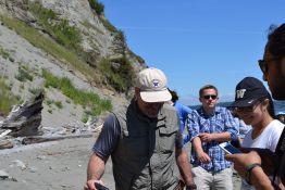
Studying the Pacific Northwest's geology is an immersive experience for students taking UW's Introduction to Geology class.
Read more »Studying the Pacific Northwest's geology is an immersive experience for students taking UW's Introduction to Geology class.
Read more »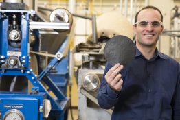
When wrapped around a pipe, this new smart paper—developed at the University of Washington—can detect water leaks and wirelessly alert a technician who could quickly locate and repair a leak.
Read more at UW Today »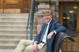
UW Environment is pleased to announce that Dan Brown will be joining the University of Washington as the new director of the School of Environmental and Forest Sciences, effective January 1, 2018. As director, Dan will play a vital role in guiding the School’s academic growth and developing new initiatives, providing leadership and management of its programs, centers, and research grants, allocating its revenues in a manner that supports its mission, and enhancing its sizable and growing endowment.
Read more »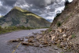
We know the "really big one" is coming. But what exactly is going to happen in cities along the coast?
Read more at UW Today »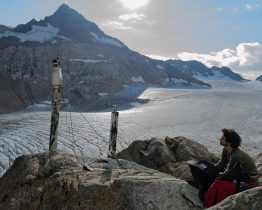
Until recently, glaciers in the United States have been measured in two ways: placing stakes in the snow, as federal scientists have done each year since 1957 at South Cascade Glacier in Washington state; or tracking glacier area using photographs from airplanes and satellites. We now have a third, much more powerful tool. While he was a doctoral student in University of Washington’s Department of Earth and Space Sciences, David Shean devised new ways to use high-resolution satellite images to track elevation changes for massive ice sheets in Antarctica and Greenland.
Read more at UW Today »