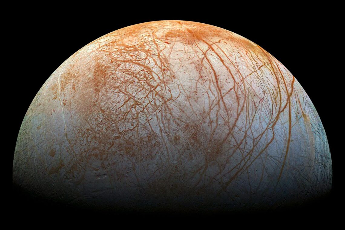
This image shows red streaks across the surface of Europa, the smallest of Jupiter’s four large moons. The upcoming Europa Clipper mission will send instruments to investigate this moon.
The ice-encrusted oceans of some of the moons orbiting Saturn and Jupiter are leading candidates in the search for extraterrestrial life. A new lab-based study led by the University of Washington in Seattle and the Freie Universität Berlin shows that individual ice grains ejected from these planetary bodies may contain enough material for instruments headed there in the fall to detect signs of life, if such life exists.
“For the first time we have shown that even a tiny fraction of cellular material could be identified by a mass spectrometer onboard a spacecraft,” said lead author Fabian Klenner, a UW postdoctoral researcher in Earth and space sciences. “Our results give us more confidence that using upcoming instruments, we will be able to detect lifeforms similar to those on Earth, which we increasingly believe could be present on ocean-bearing moons.”
The open-access study was published March 22 in Science Advances. Other authors in the international team are from The Open University in the U.K.; NASA’s Jet Propulsion Laboratory; the University of Colorado, Boulder; and the University of Leipzig.
Cryptic carbon: UW study finds hidden wetlands in the forest
Anthony Stewart
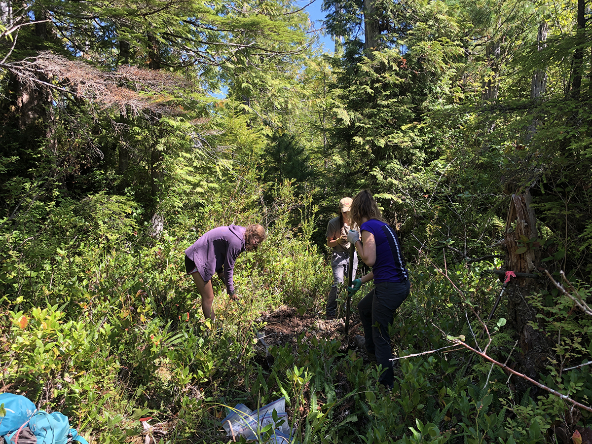
Undergraduate researchers Abby Nesper, Hazel Sanders and Claire Johnson gather wetland soil samples in the Hoh River watershed.
When it comes to climate change, an important question is not simply how can humans stop emitting greenhouse gases, but how can we remove the greenhouse gases that we’ve already released?
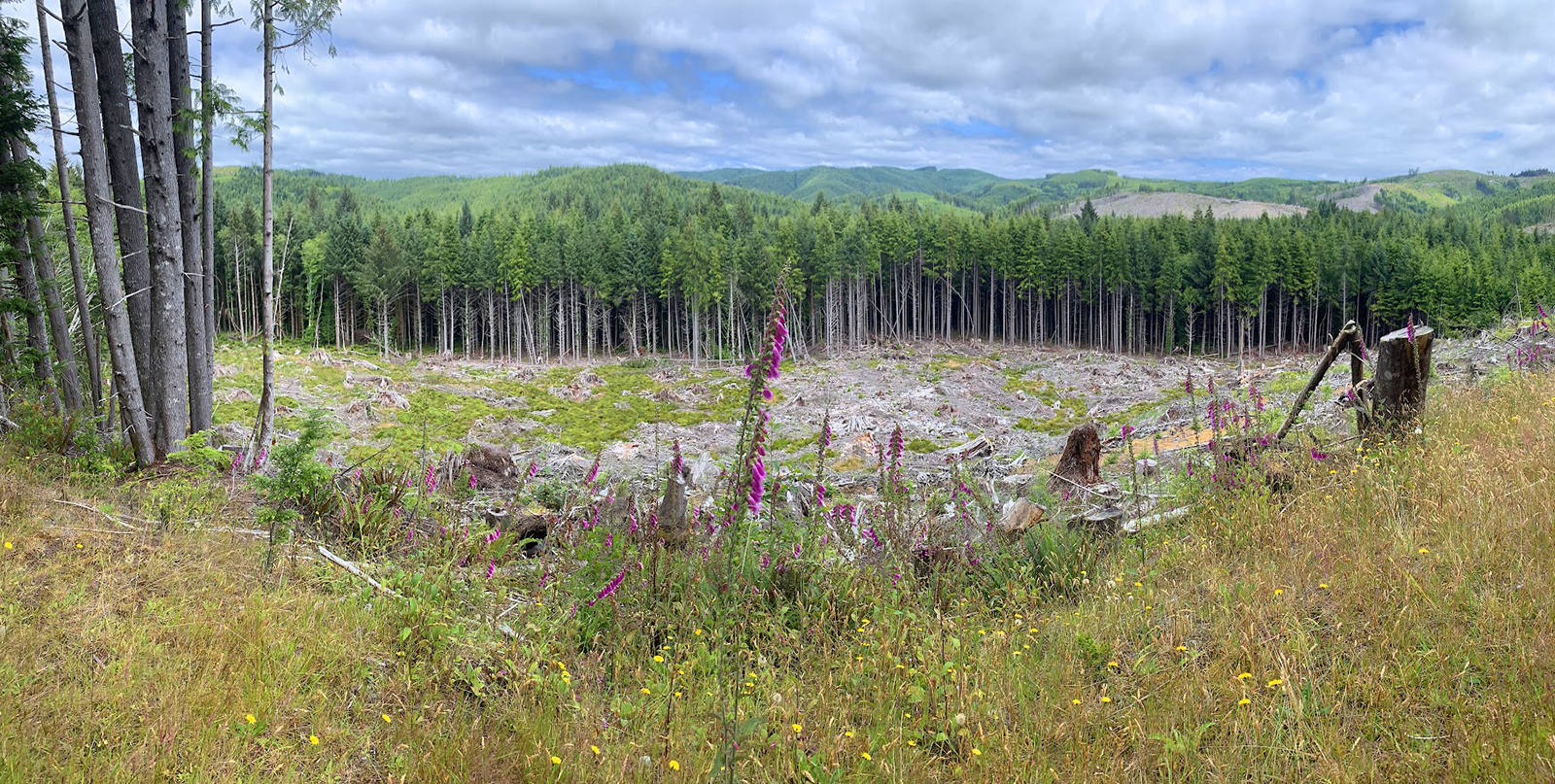
Many of Earth’s natural processes are already taking significant amounts of carbon dioxide out of the atmosphere, and our wetland ecosystems are some of the most effective at this work. These iconic locales, ranging from coastal mudflats to inland marshes, trap enormous amounts of carbon and serve crucial ecological functions that impact humans and wildlife alike. But a recent study led by UW researchers has located unmapped wetlands hiding in our forests — and found that they contain nearly five times more carbon than previously mapped areas.
“We call them ‘cryptic wetlands,’” said Anthony Stewart, a doctoral candidate in the School of Environmental and Forest Sciences and lead author on the study that appeared in Nature Communications. “They’re hard to locate with aerial photography because they’re covered by the tree canopy all year round, which means that there are lots of wetlands not being included in our national databases and maps. That leads to a very big underestimation of how much wetland carbon is actually out there.”
Locating these hidden, forested wetlands and figuring out how to protect them is urgent work, and could be a powerful tool in humanity’s approach to mitigating climate change.
Meghan Halabisky
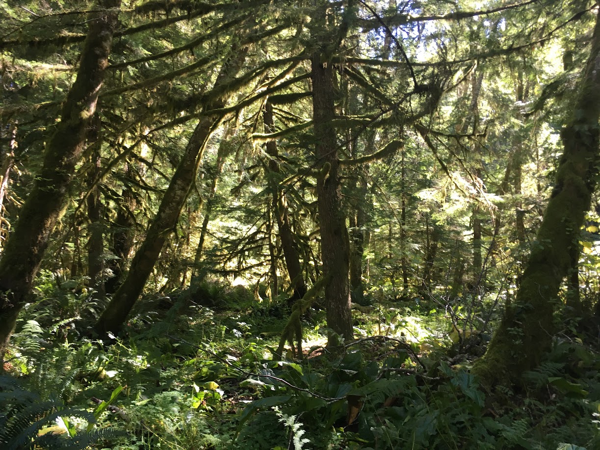
Example of a forested wetland in the Hoh River watershed.
‘Unsung heroes’ of the landscape
Most carbon on land is stored in the soil. Plants take carbon dioxide out of the atmosphere via photosynthesis, incorporate it into their cells, and when they die and decompose, that carbon becomes part of the soil itself. Ecosystems that take up more carbon than they release are known as “carbon sinks.”
Wetlands are particularly good carbon sinks because waterlogged soil is very low in oxygen. Plant matter decays much slower without oxygen present, which allows the carbon to remain intact rather than being released back into the atmosphere.
“They’re the unsung heroes of the landscape,” said Meghan Halabisky, a UW research scientist and co-author of the study. “They build climate resilience both directly by storing carbon and indirectly by mitigating the effects of climate change.”
In addition to removing carbon from the atmosphere, wetlands help improve water quality, reduce the impact of flooding, provide cool water to streams and rivers during the hot summer months, and serve as habitats for many unique species of plants and animals.
But the hidden wetlands the researchers investigated don’t look like your typical swamp.
“They’re really quite gorgeous,” Halabisky said. “They can be fully or partially covered by the tree canopy, and rather than standing water they often have hummocks, large bumps in the terrain with high and low spots. It’s mucky, muddy and hard to walk through, and they have unique plants that are specifically adapted to that low-oxygen soil environment.”
Because they’re so remote and covered by trees, these cryptic wetlands aren’t exactly easy to find — but the researchers were confident that the waterlogged temperate rainforest along the Hoh River on Washington’s Olympic Peninsula would yield results.
“I’ve been mapping wetlands for over 15 years, and I kept seeing this rich, dark dirt in wet forests, like black gold,” Halabisky said. “I realized that it wasn’t being studied very much as a carbon sink, and it made me curious to dig deeper.”
Claire Johnson
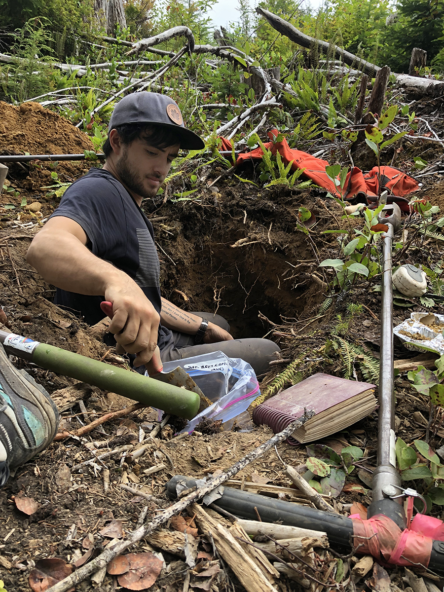
Doctoral candidate Anthony Stewart gathers soil samples.
Digging for carbon
So how do you measure carbon in remote, densely forested soils?
“We dug a lot of holes,” Stewart said, laughing. “The only way to get soil carbon measurements is to dig into the soil, since there’s no way to sense it from above.”
Using mapping software, the researchers randomly selected a number of sites in the Hoh River watershed, one of the rainiest areas in the U.S. And since the sites were truly random, there was no consideration of how hard they might be to reach.
“We would drive on these remote, backcountry forest roads, bushwhack into the woods with our shovels and hoses and pumps, and dig a pit at least three feet deep,” Stewart said. “That lets us see all the different layers of the soil.”
They then packed the soil into bags and lugged it back to campus, where they analyzed it to see how much carbon it held.
“We also used remote-sensing data to extrapolate from our findings and estimate how much carbon is stored across the landscape,” said Halabisky, whose research focuses on using drones, satellites and lidar to study wetland ecosystems from above.
What they found was surprising. Not only were the soils in these wetlands full of carbon, they also accounted for 86% of all the wetland carbon stored in the Hoh River watershed. In other words, nearly five times more carbon was stored in these cryptic wetlands than in the wetlands currently mapped by scientists and regulators.
“We’re not necessarily adding much to the total estimate of carbon storage in the area,” Stewart said. “But what we found is that much of it is stored in these cryptic carbon hotspots, and we don’t currently manage our land to conserve them.”
The future of wetland conservation
Meghan Halabisky
A previously forested wetland in the Hoh River watershed that has been logged.
While defining what counts as a wetland may seem like a purely academic exercise, it has significant implications for conservation efforts. Because these forested wetlands have been difficult to find, they haven’t generally been included on government maps or covered by existing wetland protection regulations.
Additionally, the U.S. Supreme Court’s recent decision in Sackett v. Environmental Protection Agency created a significant conservation challenge: Now, in order for a wetland to be protected under federal law, it needs to have a connection to a permanent surface waterway such as a river or a lake.
“Other researchers, such as Irena Creed at the University of Toronto Scarborough, have shown that these wetlands are interconnected throughout the landscape even though it may not be obvious on the surface,” Stewart said. “This is a missing piece of the ecosystem that we have to consider when making conservation decisions.”
“You have the legal definition of a wetland, and then you have the ecological reality on the landscape,” said David D’Amore, a soil scientist with the USDA Forest Service and co-author of the study. “We can now predict where these forested wetlands are, and then land management plans can take that into consideration.”
With climate change impacts becoming an everyday reality, those federal land management plans are also increasingly concerned with protecting carbon sinks. Identifying carbon that is currently stored in the environment and predicting how it will be impacted by changes to land use is now a priority within the Forest Service.
But the future of wetland conservation remains uncertain, and the researchers expressed that further research was urgently needed to better understand these ecosystems and maintain their integrity.
“Washington state has pretty strong wetland protection laws, so that provides a buffer,” Halabisky said. “But many states do not, and things are going to change very quickly there.”
Scaling up
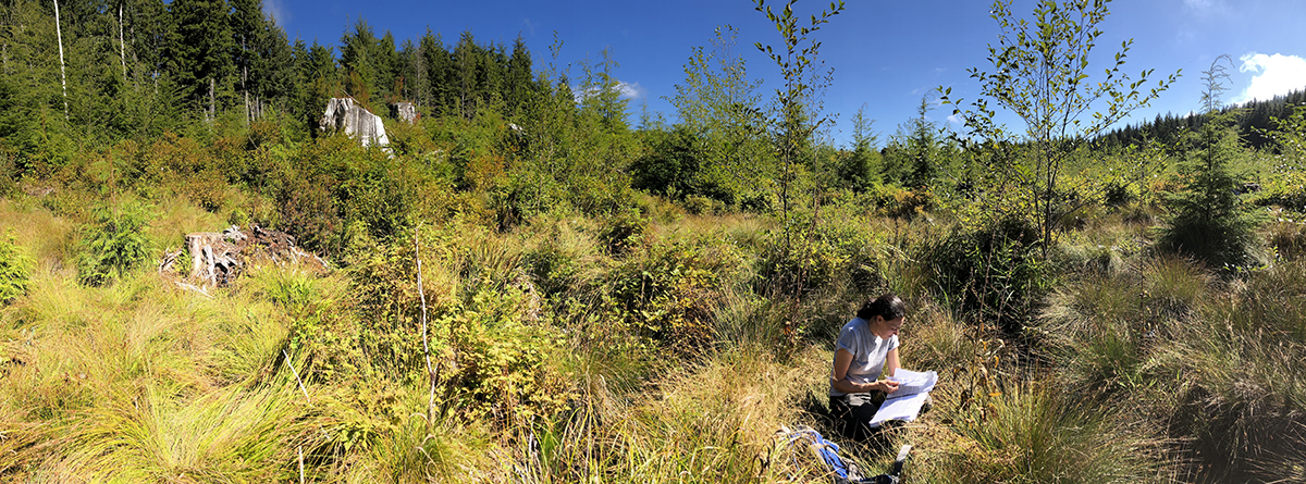
Anthony Stewart
Research scientist Meghan Halabisky takes notes in the field.
As is often the case, this study raised almost as many questions as it answered.
“There is so much more to learn,” Stewart said. “Have these wetlands been disturbed by previous forestry practices? If so, does that contribute to more or less carbon in the soil? Does this soil carbon have particular properties that make it more resistant to decomposition? Does it play a large role in how the landscape functions?”
This study was funded in part by a Phase 1 grant from the NASA Carbon Monitoring System, and recently received an additional $1 million in Phase 2 funding that will allow the team to expand its research into other geographical areas.
“We’re going to take this model and scale it up, first to Washington state and eventually the whole country,” Halabisky said. “The goal is to get these hotspots included in our carbon mapping so we can make informed conservation decisions going forward.”
The project will continue to be a close collaboration between the UW researchers and partners with the Washington State Department of Ecology, the USDA Forest Service and the EPA, which has helped to facilitate its national scope.
In the meantime, these cryptic wetlands will continue to do the important work of keeping carbon in the ground — out of sight, but no longer out of mind.
Cherry trees on the University of Washington’s Seattle campus are waking up and getting ready to say hello. For the 29 iconic Yoshino cherry trees in the UW Quad, peak bloom will likely begin after March 20, according to UW arborist Sara Shores.
“Historically, peak bloom in the Quad typically begins during the third full week of March and goes into the fourth week of March. That seems to be what this year is going to look like,” said Shores. “Right now, I would guess that the last two weekends of March are ideal viewing conditions.”
Check this UW News post for updates on the latest estimates, which could change based on weather conditions. This UW cherry blossom visitor’s site has info and tips on viewing the blossoms.
Since 2018, a UW research group has been monitoring campus blossoms from January to April with the goal of creating a model that will use weather data to predict the timing of peak bloom. Marlee Theil, a graduate student in the School of Environmental and Forest Sciences, currently leads the monitoring team of more than 20 undergraduates.
“The data that we gather will not just help us know in future years when to come to campus to enjoy the trees,” said Theil. “This will also be a valuable research tool to understand how these trees respond to changing environmental conditions.”
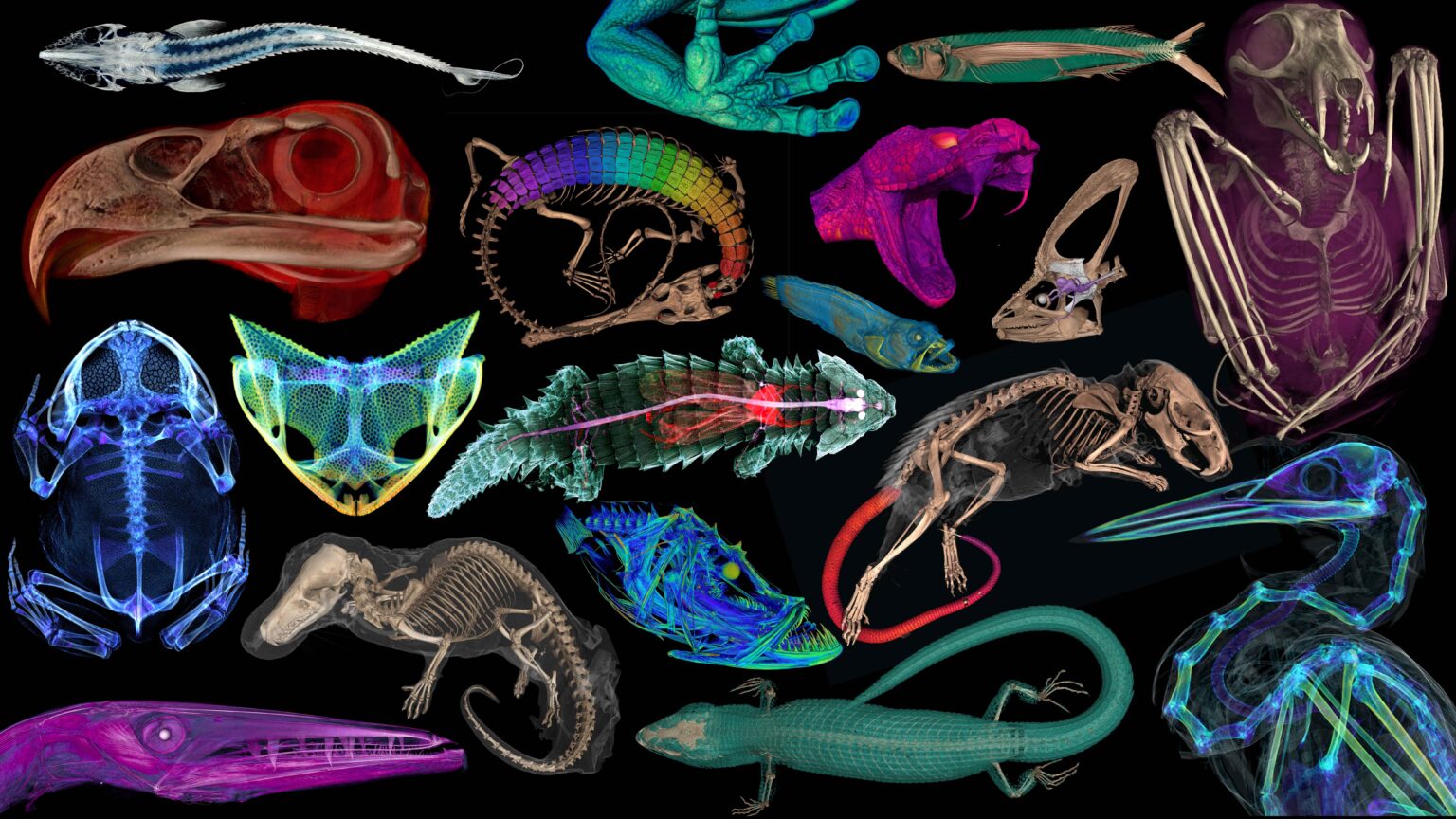
Scientists CT-scanned thousands of natural history specimens, which you can access for free
openVertebrate
A sampling of the more than 13,000 specimens scanned as part of the oVert project.
Natural history museums have entered a new stage of discovery and accessibility — one where scientists around the globe and curious folks at home can access valuable museum specimens to study, learn or just be amazed. This new era follows the completion of openVertebrate, or oVert, a five-year collaborative project among 18 institutions to create 3D reconstructions of vertebrate specimens and make them freely available online.
The team behind this endeavor, which includes scientists at the University of Washington and its Burke Museum of Natural History & Culture, published a summary of the project March 6 in the journal BioScience, offering a glimpse of how the data can be used to ask new questions and spur the development of innovative technology.
Between 2017 and 2023, oVert project members took CT scans of more than 13,000 vertebrate specimens. For the project, a team at the UW’s Friday Harbor Laboratories scanned more than 7,200 specimens — mostly fish, but also reptiles, amphibians and mammals — using the facility’s micro-CT scanner. Many of the specimens scanned at Friday Harbor came from the Burke Museum’s permanent collection. The UW team also trained more than 150 researchers, students and educators from around the world on how to CT scan specimens and analyze them for study purposes.
“It is so exciting to deposit the skeletal data for a new species in a repository where any scientist can access it,” said oVert team member Adam Summers, a UW professor of biology and of aquatic and fishery sciences, who is based at Friday Harbor Labs.
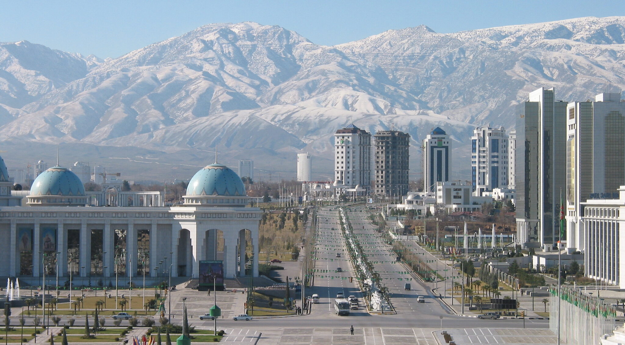
AI analysis of historical satellite images show USSR collapse in 1990s increased methane emissions, despite lower oil and gas production
Cercamon/Flickr
The capital city of Turkmenistan, Ashgabat, in 2009.
The collapse of the former Soviet Union in 1991 had social, political and economic effects worldwide. Among them was a suspected role in slowing human-generated methane emissions. Methane had been rising steadily in the atmosphere until about 1990. Atmospheric scientists theorized that economic collapse in the former USSR led to less oil and gas production, and thus a slowdown in the rise of global methane levels, which has since resumed.
But new University of Washington research uses early satellite records to dispute that assumption. The study, published March 12 in the Proceedings of the National Academy of Sciences, finds that methane emissions in Turkmenistan, a former Soviet republic and major oil producer, actually increased in the years following the dissolution of the Soviet Union.
“Methane has these enigmatic trends that we don’t really understand,” said senior author Alex Turner, a UW assistant professor of atmospheric sciences. “One that has always been fascinating is this slowdown in 1992. We find that the collapse of the Soviet Union seems to result, surprisingly, in an increase in methane emissions.”