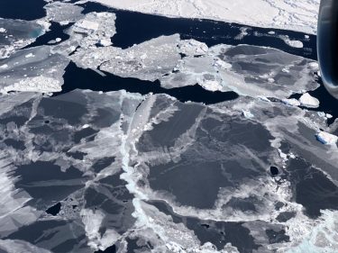
Less than three months into its mission, NASA’s Ice, Cloud and land Elevation Satellite-2, or ICESat-2, is already exceeding scientists’ expectations. The satellite is measuring the height of sea ice to within an inch, tracing the terrain of previously unmapped Antarctic valleys and measuring other interesting features in our planet’s elevation.
Benjamin Smith, a glaciologist with the University of Washington and member of the ICESat-2 science team, shared the first look at the satellite’s performance at the American Geophysical Union’s annual meeting Dec. 11 in Washington, D.C.
Mountain valleys “have been really difficult targets for altimeters in the past, which have often used radar instead of lasers and they tend to show you just a big lump where the mountains are,” Smith told the BBC. “But we can see very steeply sloping surfaces; we can see valley glaciers; we’ll be able to make out very small details.”
Read more at UW Today »
