Outlook for the polar regions in a 2 degrees warmer world
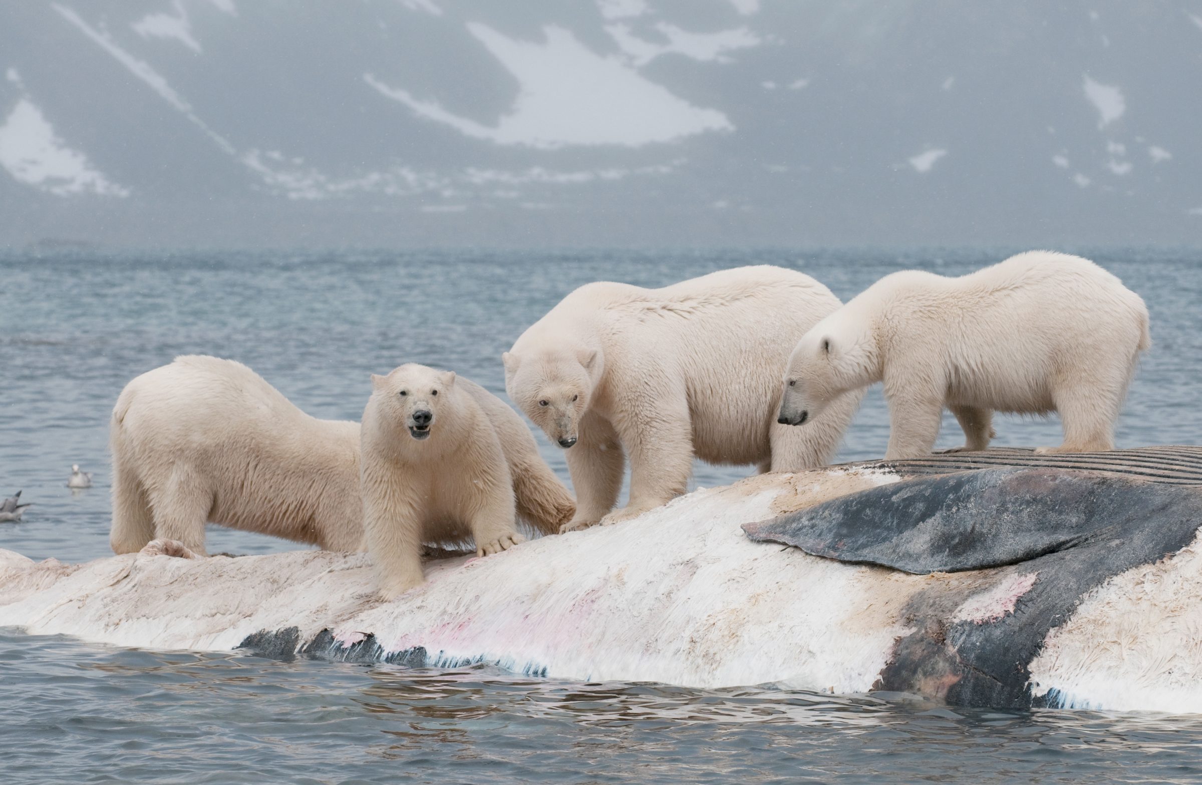
Daniel J. Cox/Arctic Documentary Project
Four male polar bears standing on a floating whale carcass shortly after it drifted to shore on the island of Svalbard.
With 2019 on pace as one of the warmest years on record, a new international study reveals how rapidly the Arctic is warming and examines global consequences of continued polar warming.
The study, published Dec. 4 in the journal Science Advances, reports that the Arctic has warmed by 0.75 degrees C in the last decade alone. By comparison, the Earth as a whole has warmed by nearly the same amount, 0.8 C, over the past 137 years.
The comprehensive report represents the efforts of an international team of 15 authors, including Kristin Laidre at the University of Washington, who specialize in an array of disciplines, including the life, Earth, social and political sciences. They documented widespread effects of warming in the Arctic and Antarctic on wildlife, traditional human livelihoods, tundra vegetation, methane release, and loss of sea- and land-ice.
“What’s happening in the Arctic is profound and unprecedented,” said Laidre, a UW research scientist at the Polar Science Center and associate professor in the School of Aquatic and Fishery Sciences. “Marine mammals rely on the sea ice platform for most aspects of their life and it is rapidly disappearing. This has cascading impacts on the ecosystem, species interactions, and indigenous humans who rely on these animals for nutritional, cultural and economic purposes.”
UW scientist to lead NASA field study of East Coast snowstorms
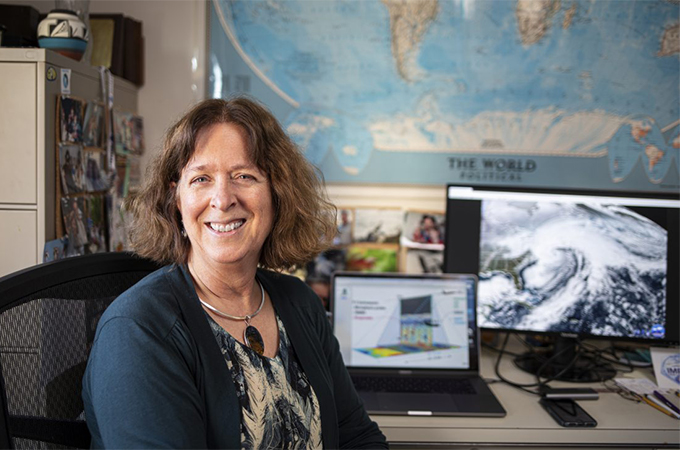
Mark Stone/University of Washington
Atmospheric scientist Lynn McMurdie is leading the NASA IMPACTS field campaign, the largest study of Northeast snowstorms to date.
Snowstorms can wreak havoc across the United States, but especially on the East Coast. Snow is the least-understood form of precipitation, with major snowstorms among the most difficult weather events to forecast. Yet people rely on these forecasts to stay safe, plan travel routes and decide whether to close schools or businesses.
To better understand large, disruptive snowstorms, a University of Washington atmospheric scientist will lead a NASA field campaign this winter to fly through major snowstorms along the East Coast. The multi-institutional team will observe snow as it forms in clouds to help with satellite monitoring of snowfall and ultimately improve forecasts.
“In a big snowstorm, the snow is not evenly distributed. Some places really get hammered, but others, even close by, don’t get nearly as much. We want to understand the processes behind that,” said principal investigator Lynn McMurdie, a UW research associate professor of atmospheric sciences.
The NASA Investigation of Microphysics and Precipitation for Atlantic Coast-Threatening Storms, or IMPACTS campaign, will be based at NASA’s Wallops Flight Facility on the Virginia coast. The six-week campaign runs Jan. 15 through late February 2020, with additional campaigns in the same region in the winters of 2021 and 2022.
Barrels of ancient Antarctic air aim to track history of rare gas
Richard Smith
A drones-eye view of the Law Dome drilling site, during the Law Dome Hydroxyl Project.
Ancient air samples from one of Antarctica’s snowiest ice core sites may add a new molecule to the record of changes to Earth’s atmosphere over the past century and a half, since the Industrial Revolution began burning fossil fuels on a massive scale.
While carbon dioxide and methane are well known, researchers at the University of Washington and the University of Rochester are part of a team working to trace a much rarer gas, present at less than one in a trillion molecules. Though rare, the atmospheric detergent known as hydroxyl can scrub the atmosphere and determine the fate of more plentiful gases that affect Earth’s climate.
An Antarctic field campaign last winter led by the U.S. and Australia has successfully extracted some of the largest samples of air dating from the 1870s until today. These samples are a first step to learning the changes in hydroxyl concentration over the past 150 years. Early results from the fieldwork were shared this week at the American Geophysical Union’s annual fall meeting in San Francisco.
“It’s probably the most extreme atmospheric chemistry you can do from ice core samples, and the logistics were also extreme,” said Peter Neff, a postdoctoral researcher with dual appointments at the UW and at the University of Rochester.
In 2013, the United Nations designated December 5 as World Soil Day. The date coincides with the birthday of the late King Rama IX of Thailand, a leading global advocate for the promotion of healthy soils and sustainable soil management. This World Soil Day, we’re digging into the history of soil science and looking ahead to see what the future holds for the oft-overlooked hero of our terrestrial ecosystem.
Why celebrate soils?
Simply put, soils are the foundation of nearly all ecosystems. They play critical roles in water and nutrient storage, provide habitat for an immense variety of organisms and are the medium in which vital environmental processes occur.
Soil – simple in concept if not in substance – is actually a combination of five varying elements:
minerals (clay, silt or sand),
organic matter (residues of plants, animals and microbes),
living organisms (bacteria, fungi, nematodes and other microbes),
gas (nitrogen, carbon dioxide and oxygen) and
water
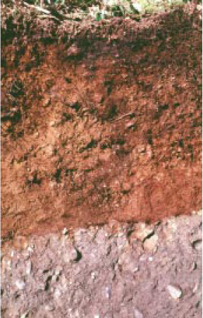
Tokul is Washington’s official state soil, consisting of a surface rich in decaying plant matter, a layer of iron and a layer deposited from glaciers that is mixed with ash from volcanic eruptions.
The various combinations of these elements give us the infinitely diverse range of soils and soil-life that we see throughout the world. In fact, Washington has an official state soil called Tokul, named after a creek and community in King County. Tokul is a productive and rich volcanic soil found only on the western side of the Cascade Mountains. Vital for the health of western Washington’s evergreen forests, this natural resource also stores and filters the water that Seattle and surrounding towns depend on.
What do our scientists love about soil?
We asked a few of our leading soil researchers to explain why soils matter.
Brittany Johnson, Environmental and Forest Sciences
“Soils provide a multitude of ecosystem services. They supply the building blocks for plant life including water, nutrients, physical support and protection from toxins. Soils drive the hydrologic cycle, influence greenhouse gas emissions and sequestration and change the energy balance of the Earth’s terrestrial surface.”
Robert Harrison, Environmental and Forest Sciences
“More carbon is found in soil than in the entire atmosphere and in all plant and animal life combined. Small changes in soil carbon would have a large impact on carbon emissions or uptake.”
Katharine Huntington, Earth and Space Sciences
“Soils record information about climate and plants in their chemistry. That means geologists can analyze the chemistry of ancient soils to learn about past surface temperatures, rainfall, atmospheric carbon dioxide levels and ecosystems.”
David Montgomery, Earth and Space Sciences
“Upwards of 97% of the food we rely on is dependent on the health of our soils. Healthy soil is vitally important for healthy crops, which in turn can increase the nutrients found in those crops. Regenerative practices can improve the soil and lead to healthier humans through a variety of mechanisms.”
What are the challenges to maintaining healthy soil?
Over one-third of all of Earth’s soil has been degraded since the advent of agriculture, and it can take over one thousand years to produce just two to three centimeters of productive soil in nature. The Food and Agriculture Organization of the United Nations highlight ten threats to healthy soils throughout the globe:
soil erosion – largely due to water, wind and tilling
organic carbon change – loss of carbon in the soil
salinization and sodification – build-up of water-soluble salts
nutrient imbalance – improper levels of micronutrients
contamination – increases in heavy metals and pesticides
soil sealing and land take – loss of surface-exposed soil
soil acidification – improper use of chemical fertilizers increases soil pH
compaction – livestock trampling and heavy mechanization of land management
waterlogging – poor drainage systems and deforestation oversaturate soils
loss of soil biodiversity – reductions in the diversity of living organisms within soils
In nearly all cases, the threat is created or made worse by human activities, but by utilizing effective soil resource management practices, it is possible to rejuvenate soil. Addressing these challenges require extensive research and collaboration, as well as individual behavior change throughout the community.
How can you help look after our soils?
Participate in World Soil Day activities! The Global Soil Partnership has a wonderful infographic showing ways you can get involved, and a map of worldwide events that you can attend. Use #WorldSoilDay and #StopSoilErosion to join the global conversation.
Become a soil advocate! Educate yourself on the issues (and their solutions), and share your newly found knowledge with those around you. Flex your civic muscles and ask your elected representatives to place a larger importance on soil protection and regeneration policies.
Turn your research into action! Whether you have a home garden or you participate in a communal ‘P-Patch’, make an extra effort to consider the quality of your soil and work to improve it. The city of Seattle has a straightforward and informative guide to managing your soil quality.
Donate to a soil-related nonprofit organization! There are many impactful nonprofit organizations that place an emphasis on preventing soil degradation; seek out one that is important to you, and contribute to their work.
And, if you’re a student here at University of Washington, you may want to check out the soil-related classes and resources in the School of Environmental and Forest Sciences, Department of Earth and Space Sciences, Civil and Environmental Engineering, and the UW Botanic Gardens!
Better wildfire and smoke predictions with new vegetation database
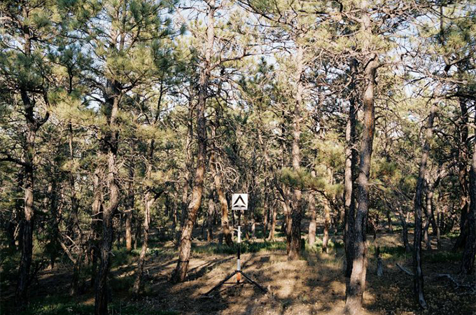
University of Washington
Ponderosa pine forests, like the one pictured here, are among the six forest types highlighted in this study. Ponderosa is widespread in semi-arid landscapes in western North America.
It’s hard to find a place in the U.S. that isn’t impacted by wildfires and smoke.
Dry landscapes, warmer temperatures and more development near forested areas all contribute to massive wildfires across North America each year. Smoke and haze from these fires can travel hundreds of miles from their source, affecting the health and wellbeing of communities across the U.S.
Given these impacts, scientists rely on models that try to predict the severity of wildfires and smoke. The amount of living and dead vegetation on a landscape, known as fuels, is a key part of the equation when modeling wildfire and smoke behavior. But in many areas, fuel estimates are imprecise, leading to unreliable smoke and fire forecasts — potentially endangering communities.
Researchers from the University of Washington and Michigan Technological University have created the North American Wildland Fuel Database, the first comprehensive database of all the wildfire fuels that have been measured across North America. The tool incorporates the best available measurements of vegetation in specific locations and allows fire managers to see where information about fuels is missing altogether.
“Where there are fuels and fire, there’s smoke,” said lead author Susan Prichard, a research scientist at the UW School of Environmental and Forest Sciences. “This database is informing more realistic predictions of smoke that allow for the fact that we might not have dialed in the fuels perfectly.”
The new database is described in a paper published Dec. 4 in the Journal of Geophysical Research – Biogeosciences.
For some corals, meals can come with a side of microplastics
Dennis Wise/University of Washington
Jeremy Axworthy removes a young coral from a tank in the lab. The two coral species shown here are Pocillopora damicornis (left), known as cauliflower coral, and Montipora capitatae (right), or rice coral. Cauliflower coral was more likely to ingest microplastics during the team’s experiments.
Tiny microplastic particles are about as common in the ocean today as plastic is in our daily lives.
Synthetic clothing, containers, bottles, plastic bags and cosmetics all degrade and release microplastics into the environment. Corals and other marine organisms are eating microplastics that enter the waterway. Studies in this emerging field show some harmful effects, but it’s largely unknown how this ubiquitous material is impacting ocean life.
A new experiment by the University of Washington has found that some corals are more likely to eat microplastics when they are consuming other food, yet microplastics alone are undesirable. Two coral species tested responded differently to the synthetic material, suggesting variations in how corals are adapting to life with microplastics. The study was published Dec. 3 in the journal Scientific Reports.
“The more plastic we use, the more microplastics there are, and the more corals are going to be exposed,” said lead author Jeremy Axworthy, a UW doctoral student in the School of Aquatic and Fishery Sciences. “Our study found that some corals probably won’t eat microplastics and will keep going about their daily business. But some might — and if they happen to be sensitive to warmer ocean temperatures or other stressors, this is just another compounding factor to be worried about.”
This study is the first to examine whether corals eat microplastics when exposed to warmer water, which is expected to accelerate with climate change. Rising ocean temperatures can be deadly for coral: warm water stresses them, causing corals to lose their symbiotic algae partner that undergoes photosynthesis and provides energy for them to survive. When this happens, coral bleaching and eventual death can occur.
Take a peak: 10 facts about the tallest mountain on Earth
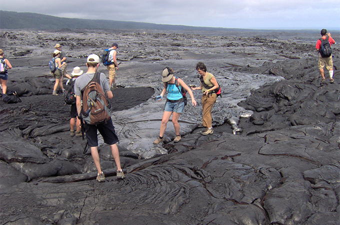
Bruce Nelson
Earth and Space Sciences’ GeoClub students in Hawaii.
When thinking of the “biggest” mountains on Earth, many people immediately think of Mount Everest or Denali, but some of the biggest mountains actually start below sea level and grow into islands. At over 33,000 feet, Mauna Kea in Hawaii reigns supreme as the biggest mountain on Earth as measured from base to top. Let’s explore the ways in which these mountains are different, both in how they are made and their geologic setting.
Mountains like Mount Everest or the Rockies are made by tectonic forces that crumple the crust and cause an enormous uplift. By contrast, Hawaiian volcanoes are formed by magma with origins from very deep in the earth when a plume forms from near the Earth’s core and rises up to form the volcano. The plume from the core-mantle boundary is solid – it is essentially hot rock at this point, so it flows very slowly and starts melting into material that turns into lava from 120-200 km below the surface of the Earth. We sat down with Earth and Space Sciences professor Bruce Nelson to talk about 10 facts people may not know about the Hawaiian volcanoes.
The magma that rose up to form all of the Hawaiian volcanoes including Mauna Kea came from near the Earth’s core. This material is the closest we can get to getting indirect samples from the bottom of the Earth’s mantle (2,900 km deep).
Mauna Kea and Mauna Loa formed very quickly, geologically speaking. They formed in a few hundred thousand years, as opposed to other non-volcanic mountains around the world which typically require tens of millions of years.
Part of the life history of very large mountains is that they become gravitationally unstable. Most Hawaiian volcanoes have grown too big to support themselves and have collapsed under their own weight, possibly generating giant tsunamis. This hasn’t happened anytime in human history, but studies have shown that collapse events are frequent over geological time scales. When looking at outlines of the Hawaiian Islands, you may notice that some volcanoes look like they have been cut in half, or had large “bites” taken out of them, instead of appearing to be a perfect circle. This is because a large part of the volcano has slid into the sea. It’s rare to see a perfectly circular ocean volcano.
Dormant volcanoes aren’t growing at all and can only decrease in size.
Islands slowly sink under the surface of the sea over time. The tectonic plate they’re on moves them away from the hot plume so the volcanoes and underlying crust are cooling off and starting to sink. The tectonic plate is constantly moving to the northwest. So, new Hawaiian Islands are constantly being formed under the sea.
The Hawaiian mountains that we see are just one end of a long chain of mountains that reach all the way to Japan, and all the way to the ocean floor. Right now, Kīlauea and Mauna Loa are over the plume and are considered “under construction.” Every other mountain to the north is under destruction.
The newest Hawaiian volcano, Lo’ihi, is 980 m under the surface of the ocean and still growing. In two to three hundred thousand years, it will emerge as a new Hawaiian island.
There are three ways in which Hawaiian volcanoes can disappear: landslides, erosion and sinking. Once a volcano sinks just below the ocean surface, and if they are within about 30 degrees of the equator, they are crowned with a coral reef. Eventually that also sinks below the depth of sunlight penetration and dies.
Mauna Kea forms and sustains five different ecosystems as you go from top of the mountain to ground level, and three to four ecosystems from water level to the base of the mountain. Mountains provide water, influence climate and preserve ecosystems. Part of the importance of mountains is their biology.
Around the world, mountains have significance to local cultures. Mauna Kea has special religious, spiritual and cultural significance to the indigenous Hawaiian people. Dozens of archeological sites at high elevations attest to its cultural importance over thousands of years.
We hope you learned something new about the Hawaiian volcanoes from this article! Next time you’re planning a tropical vacation to ocean volcanoes, be sure to impress those around you with these fun facts. Happy International Mountain Day!


 In 2013, the United Nations designated December 5 as World Soil Day. The date coincides with the birthday of the late King Rama IX of Thailand, a leading global advocate for the promotion of healthy soils and sustainable soil management. This World Soil Day, we’re digging into the history of soil science and looking ahead to see what the future holds for the oft-overlooked hero of our terrestrial ecosystem.