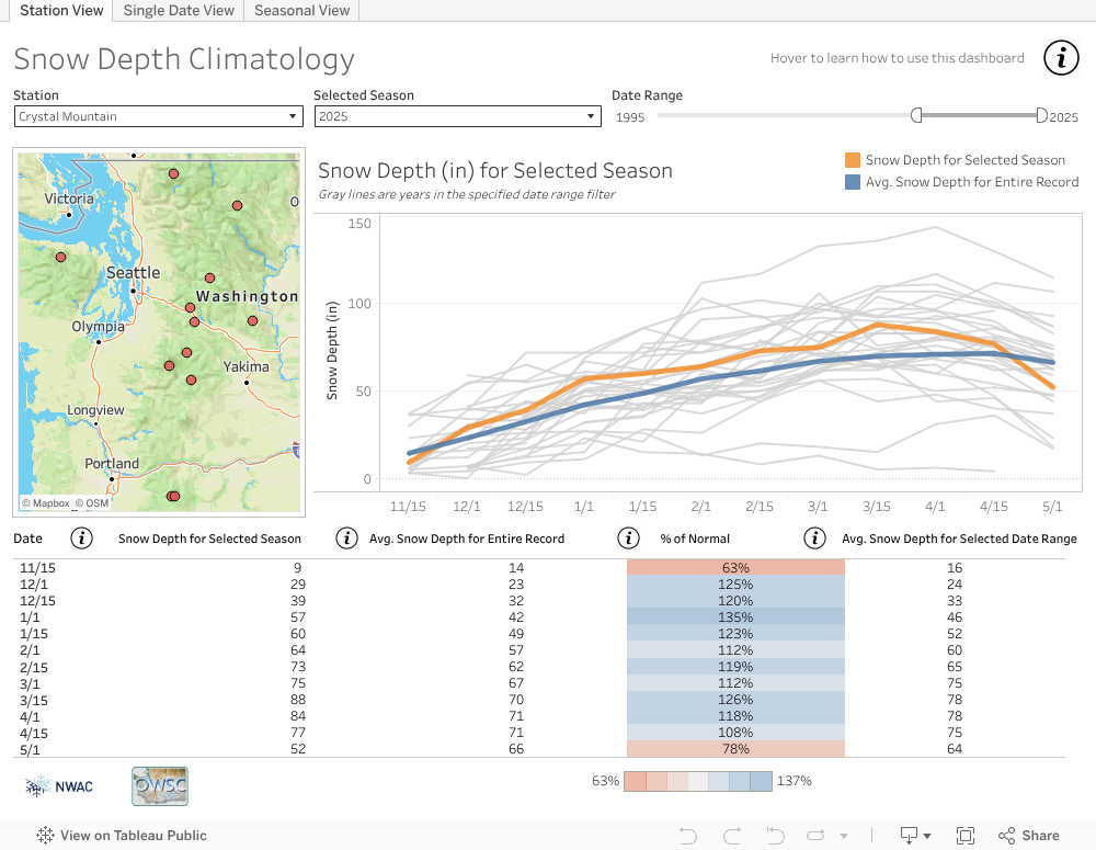
How’s the snow on Northwest mountains this year? Overall a little deeper than normal, but it depends where you look. A new collaboration between the University of Washington and the Northwest Avalanche Center lets you see how the current snow depth compares to past years for nine sites in Washington and two in Oregon.
The new mountain snow depth tool is freely available on the Office of the Washington State Climatologist’s website. It replaces a tool made more than a decade ago that collected snow depth data from the NWAC website to create a simple graphic on the state climatologist’s website.
“When that display wasn’t working, that’s the one where we would get emails from ski enthusiasts or other meteorologists or climatologists. To us that was a good sign that we should rebuild it,” said Karin Bumbaco, a Cooperative Institute for Climate, Ocean, and Ecosystem Studies research scientist who is the assistant state climatologist.
The new version, built with support from Tableau, is interactive, displays more data and is more reliable. It lets users explore differences in mountain snow depth from one season to the next and create a graphic of the results.
“This is a tool that people in the weather community, like meteorologists and climatologists, as well as snow recreationalists, can use to communicate the current snow conditions and how they relate to average conditions and previous years,” Bumbaco said.
A default view shows the current year compared to the past 30 years of data at a single location. Changing the settings can display measurements back as far as 1927 for the longest-running stations, on Mount Baker and at Paradise on Mount Rainier. Measurements go back to 1974 for the two most recent stations, at Mount Hood Meadows and Timberline in Oregon.