SLIDESHOW // A view of Mount Saint Helens erupting with a thick column of smoke, ash, and gas pouring into the sky.
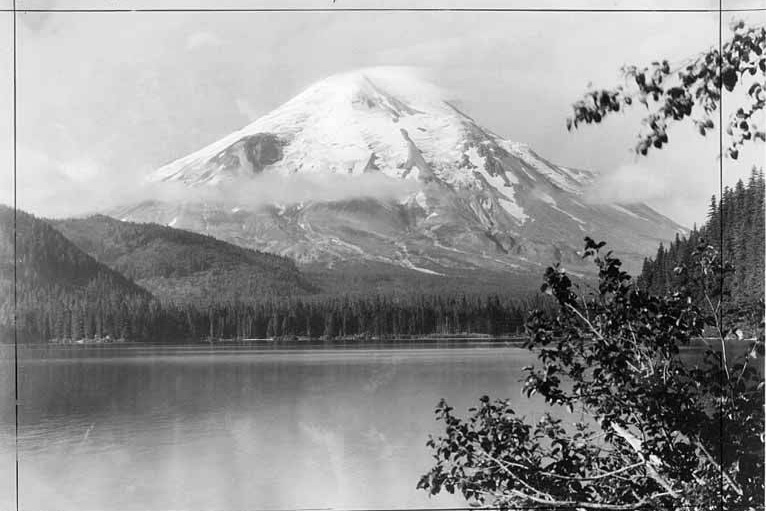
SLIDESHOW // This photograph, taken in 1923 reads "The glaciers and snowfields regulate the stream flow of the Toutle, Kalama and Lewis Rivers."
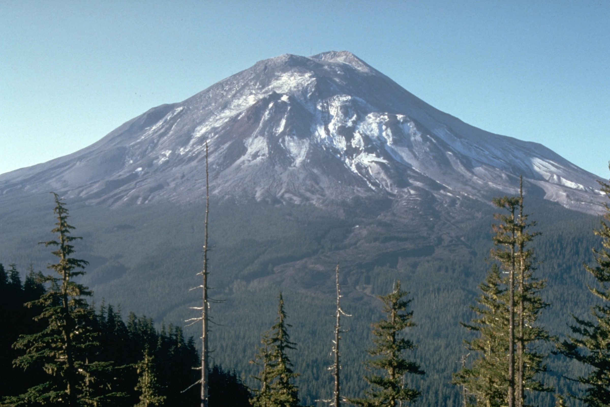
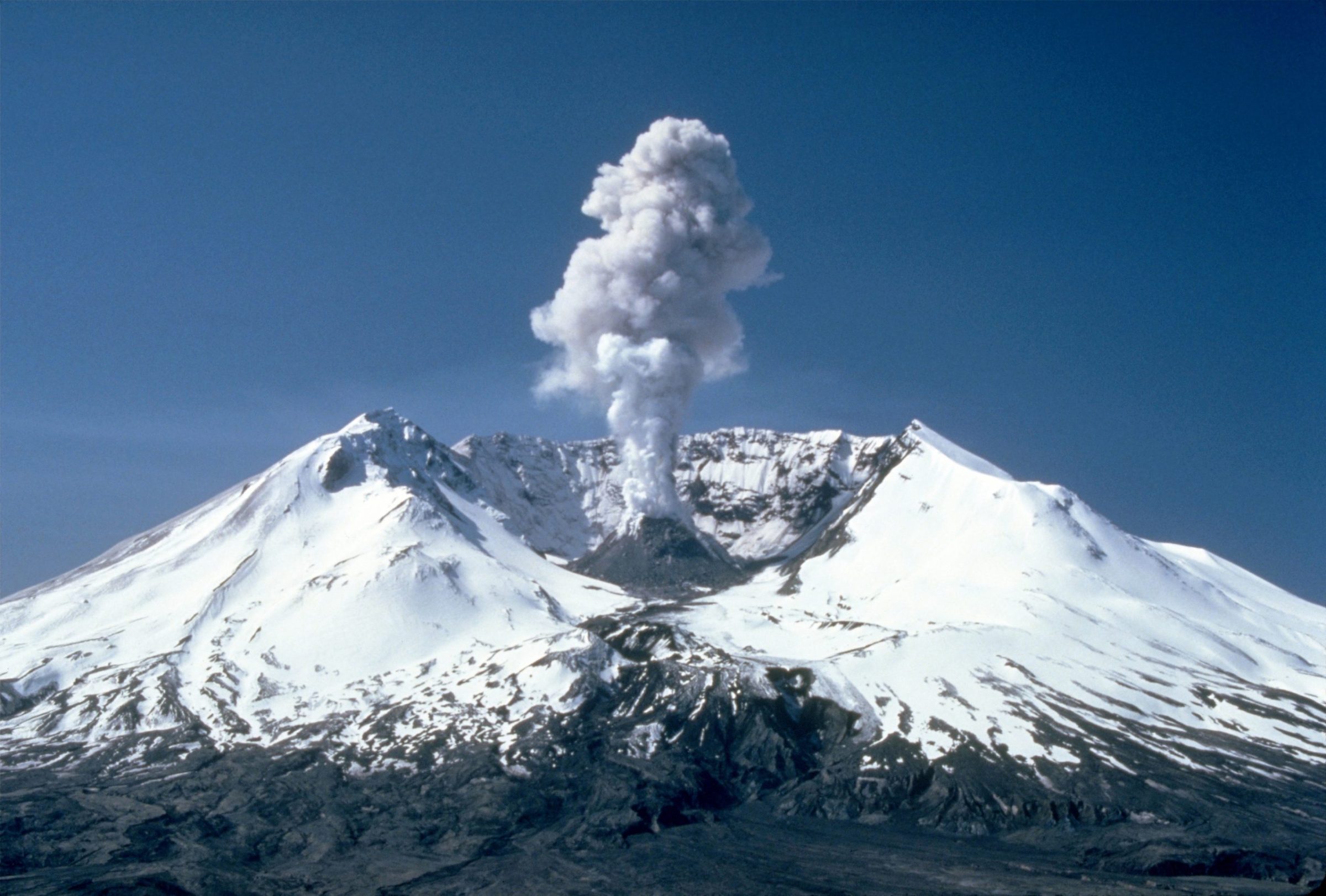
SLIDESHOW // Mount St. Helens, one day before the devastating eruption. The view is from Johnston Ridge, six miles (10 kilometers) northwest of the volcano.
SLIDESHOW // As a result of the eruption, 24 square miles (62 square kilometers) of valley was filled by a debris avalanche, 250 square miles (650 square kilometers) of recreation, timber, and private lands were damaged by a lateral blast, and an estimated 200 million cubic yards (150 million cubic meters) of material was deposited directly by lahars (volcanic mudflows) intothe river channels.
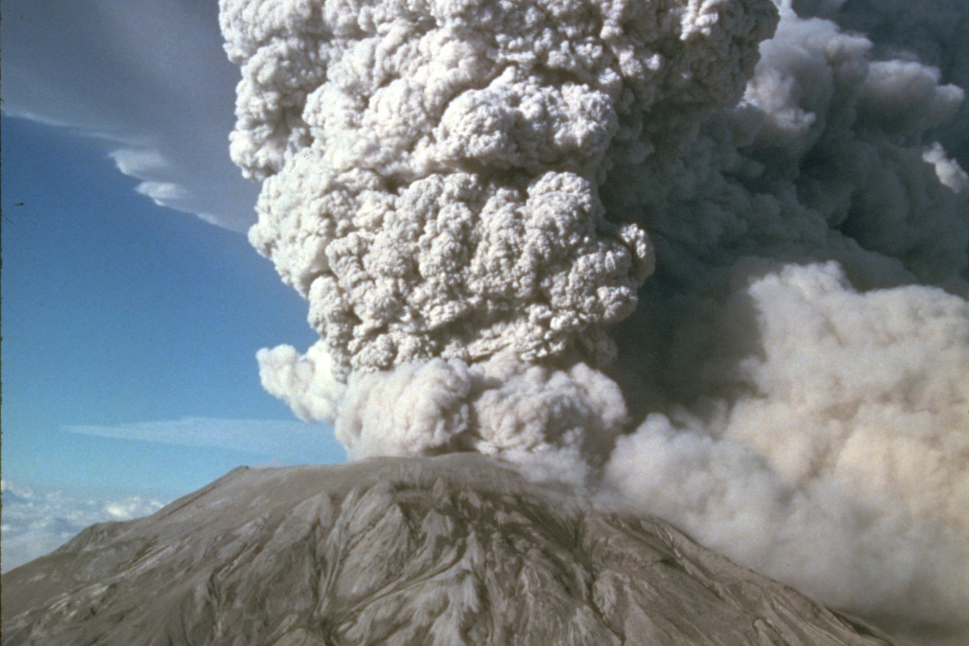
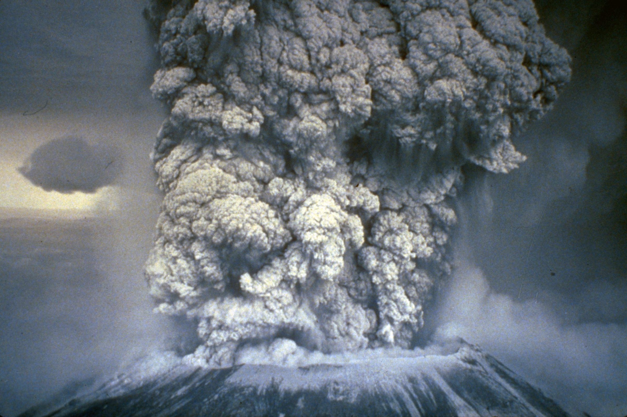
SLIDESHOW // After May 18th five more explosive eruptions of Mount St. Helens occurred in 1980, including this spectacular event of July 22nd. This eruption sent pumice and ash 6 to 11 miles (10-18 kilometers) into the air, and was visible in Seattle, Washington, 100 miles (160 kilometers) to the north. The view here is from the south.
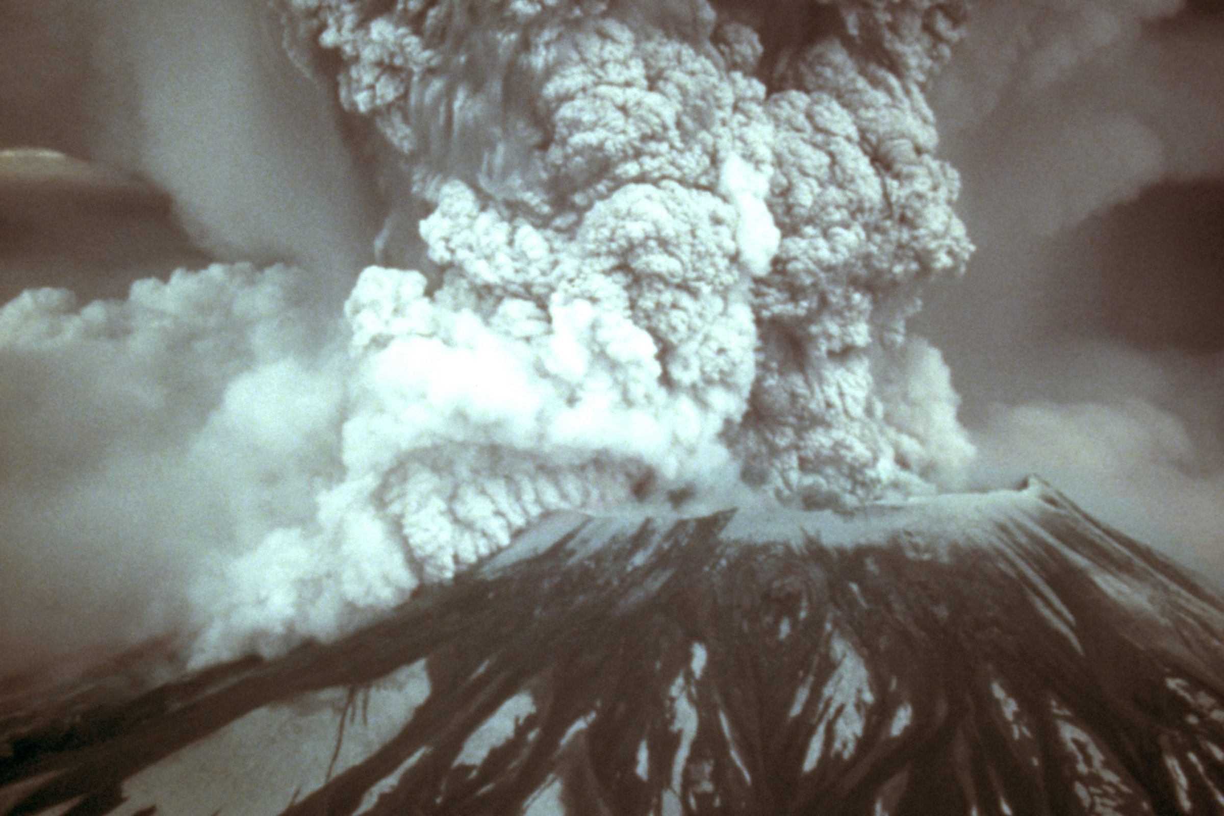
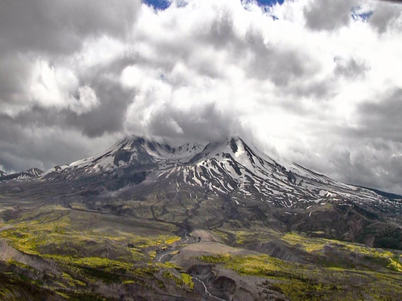
SLIDESHOW // Plumes of steam, gas, and ash often occurred at Mount St. Helens in the early 1980s. On clear days they could be seen from Portland, Oregon, 50mi (80km) to the south. The plume photographed here rose nearly 3,000ft (910m) above the volcano's rim. The view is from Harrys Ridge, 5mi (8km) north of the mountain on May 19, 1982.
It wasn’t supposed to be Mount St. Helens.

In the 1970s, scientists including Emeritus Research Professor Steve Malone (then a postdoctoral researcher at UW) investigated what they believed to be earthquakes on Mount Rainier. Further work determined they were “glacier quakes” instead: As glaciers on a mountain shift, the energy created mimics an earthquake.
Then in 1975, Mount Baker began to steam. Researchers, including Malone, placed seismographs (instruments that measure the earth’s motion), on the mountain and tracked them for several years — but that was a bust.
And then there was Mount St. Helens, which was just another volcano until after a 4.2 magnitude earthquake on March 20, 1980.
Shake it
According to the geological theory of plate tectonics, all earth’s land and water sits on large and shifting plates made of various kinds of rock. The plates slide over, under and away from each other. When they do, melted rock, or magma, may rise up through the plates. Volcanoes and earthquakes tend to occur near these plate boundaries.
Major volcanoes in the Cascade mountain range — such as Mount Rainier, Mount Hood, and Mount St. Helens — share a common tectonic plate and regularly experience earthquakes.
Mount St. Helens, however, gets the most in the entire Cascade chain.
Ironically, Malone and UW researchers had been planning on heading to Mount St. Helens in the summer of 1980 to explore its seismic activity. The March 20 quake kick-started them into action: Early the next day, they headed up the mountain to install additional seismographs to relay information to their lab on campus. They also brought recorders that would log any earth movement for five days at a time; after that, the tapes would be exchanged for fresh ones and their data analyzed by hand.
“We thought there would be some aftershocks and they’d die out, which is typical of earthquakes,” Malone recalls. “But that didn’t happen. Things were picking up, instead. We were having an earthquake swarm. That concerned me.”
He contacted the Forest Service and told the Ranger the earthquakes were continuing and likely to trigger avalanches; this led them to close the mountain to climbers. Then Malone called the U.S. Geological Survey Office, who flew out staff to determine the hazards of a potential eruption on the mountain. Malone then worked to install more seismograph stations to pick up more data.
Less than a week later, the earthquakes were coming fast and furious.
“The records at our station at St. Helens west, closest to the volcano, were saturated. You couldn’t tell one earthquake from another,” Malone says.
On March 27, Mount St. Helens got everyone’s attention with a small steam and ash eruption.
It wasn’t simply the number of earthquakes or their magnitude. It was the types of earthquakes that were happening, Malone explains.
Most earthquakes caused by tectonic plates moving — like the 1989 Loma Prieta 7.1 earthquake or the 1994 Northridge 6.2 earthquake — emit a high frequency in the type of energy waves they give off. Volcanic earthquakes, on the other hand, generally put out a lower frequency.
These were low-frequency earthquakes.
Also, location mattered. The St. Helens earthquakes were shallow. Not miles-deep under the earth, but just a few kilometers below the earth’s crust, underneath the mountain. Also, they were happening on the north slope of St. Helens.
This meant magma was rising into the volcano.
Magma in motion
Earthquakes are a sign of volatility in a volcano’s subterranean plumbing system. Thousands of earthquakes may happen in the span of a month: Volcanologists call this “harmonic tremor.” As earthquakes move toward the surface, this suggests magma moving around, like water in a building’s pipes.
By April 1980, activity was far from over: The north face of the mountain was changing. Geodetic surveys, using reflectors to measure land movement, showed the volcano was bulging out the north side. Steam explosions would come and go. It became dangerous to change the tapes at the monitoring stations: Researchers could feel the earthquakes under their feet.
This changed how Malone and others notified the volcano hazard experts at the U.S. Geological Survey (USGS) about potential dangers to people living nearby.
“There were red zones near the mountain, where only essential personnel could go, and then orange and yellow zones throughout the area where others could travel if needed,” Malone says. “I stayed behind the scenes, giving information to the hazards people who advised the U.S. Forest Service, county sheriff and state.”
He continues, “On May 17, many property owners had gone to their cabins to get stuff. They’d wanted to stay there. Highway patrol said no. So they planned to go back the next day. Of course, they didn’t.”
Even just the day before, it still wasn’t clear that the giant bulge on the north side would slide off and uncork all the magma that had moved in.
Shaking a soda can

“It’s no surprise that St. Helens would manifest spectacular unrest in our lifetimes,” UW Earth & Space Sciences professor George Bergantz says. “But in hindsight, it was tragically obvious what was about to happen.”
On May 18, 1980, a 5.2 magnitude earthquake caused the north side of Mount St. Helens to collapse, a phenomenon called a debris avalanche. Once the debris avalanche took out the mountain’s north side, magma exploded from it with the force of 1500 Hiroshima atom bombs. Instantly, the mountain’s elevation plunged from 9,600 to 8,300 feet. Ash, rocks, gas, and melted ice formed a slurry, or lahar, and careened down the mountain at 100 mph. The magma that remained vented out the top of the mountain.
“Take a soda can. Then shake it and poke a hole in the side. Liquid will shoot out,” says Bergantz. “Then if you pop the can’s top, liquid will fizz up from there as well.”
Although researchers had been monitoring seismic activity around the clock, the eruption took everyone by surprise, Malone says. They’d seen no change in the level or type of earthquakes detected from the volcano. It wasn’t an accelerating progression of any kind.
Scientists agree: This was an unbelievable event — and a discouraging one.
“Our worst-case scenario was far, far exceeded,” Malone says. “The hazard experts thought the blast might extend 10 kilometers: It went 30, instead. Fifty-seven people died. We’d had two months of warning, but nothing on a socially useful timescale, where you can react and do enough. Months are too long, and seconds are too short.”
Volcanologists at UW
In the 40 years since the eruption, much has changed, especially the technologies volcanologists use.
In 1980, all seismic changes were recorded on paper, then analyzed by hand. Now, software allows scientists to speedily process all this data and create models from it. Four decades ago, GPS tools didn’t exist. Today’s volcanologists use satellite technology to provide images at a resolution that would have been unheard of 40 years ago. And nowadays, lab-piloted drones collect samples of gases emanating from a volcano; results can indicate its potential explosiveness.
The size and scope of UW’s seismology program has also grown since the 1980s. Back then, Malone guesses, there were fewer than 10 students in the group; these days, it’s quadrupled. Teamwork has also increased: In the ensuing decades since the eruption, UW has helped create the Pacific Northwest Seismic Network (PNSN), a collaboration among UW, the University of Oregon, the USGS, the U.S. Department of Energy and the States of Washington and Oregon.

Malone is a former director of the PNSN; its current director is Department of Earth and Space Science Professor Harold Tobin. As director, he sets the agenda for PNSN’s understanding of seismic activity. The organization monitors 24/7 for any earthquakes in the area, but also works to understand the research that goes along with the surveillance.
“We investigate all activity. At the most fundamental level, we’re looking at how the earth works in the Cascadia Subduction Zone, where we’re located. It spans so much, from offshore earthquakes that cause tsunamis to the summits of inland volcanoes,” Tobin says.
And today
Learning is crucial — and outreach is too, says Malone. “Our role is not only to do science and teach students, but also to provide information to the public. That’s a very serious responsibility.”
Tobin adds, “Today, we understand a lot more about what we see, and can better warn of an impending eruption. It’s like having a stethoscope on a volcano.”
Over the past several years, UW, along with the USGS, has created a national volcano early warning system: They evaluate all the volcanic systems in the U.S., develop threat assessments and act accordingly. For example, while Mount Hood, already has some hazard instrumentation, it will receive additional resources to extend the current coverage as will Mount Baker and Glacier Peak.
But gathering information isn’t as easy as trekking up with a backpack and planting a flag in the soil. Many volcanoes are located in national parks or wilderness lands, which have strict rules and extreme permitting processes.
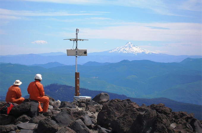
For example, researchers can’t use any power equipment; everything must be done by hand. In remote areas such as on Glacier Peak, scientists must arrive and depart via a day-long hike each way. Occasionally they can enlist a helicopter to bring in heavy equipment — but only for a single trip.
Regardless, Mount St. Helens itself continues to serve as a significant national laboratory. In the last 40 years, the team agrees, we have gained a fresh appreciation of the richness of life in extreme environments as well as knowledge of how a landscape regenerates and adapts, from microbes to plants to animals.
“Research at Mount St. Helens has yielded an incredible scientific record of the lifecycle of an eruption,” Bergantz says. “Although it began with a tragedy, from that tragedy we have a new understanding about how volcanoes can behave.”
The PNSN hosted a virtual event on Monday, May 18, 2020 on their YouTube channel. The group streamed prerecorded talks from four speakers and then hosted a live Q&A of questions on the network’s Facebook page.
Mount St. Helens’ mysteries still astound scientists, 40 years after eruption