
In the depths of the Pacific Ocean, just off the upper West Coast of the United States, a collision between an unstoppable force and an immovable object has been gathering energy for hundreds of years. The Cascadia Subduction Zone (CSZ), where the Juan de Fuca and North American tectonic plates meet, must release this pent up energy eventually in an event many refer to as “the really big one”. This release of tension could produce an earthquake with a magnitude so high that it will share a table with only five other quakes in recorded history.
The earthquake, however, will not be the only concern for residents near the coast. Shortly after the shaking stops and people begin to process what has happened, a surging wall of water will inundate some Washington State communities.
Today, World Tsunami Awareness Day, is “a good day to check in with the places you spend time,” said Carrie Garrison-Laney, a tsunami hazard specialist with Washington Sea Grant. “If you work in, or if you live in, or often visit places that are in hazard zones, inundation zones, then you need to have a little bit of extra awareness of what you will do if you feel a stronger quake.”
Tsunami sources
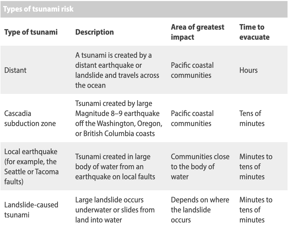
Hazard zones, inundation zones and the amount of time to evacuate to higher ground will change depending on the source of the earthquake, explained Garrison-Laney. Here are three of the riskiest sources:
The Cascadia Subduction Zone
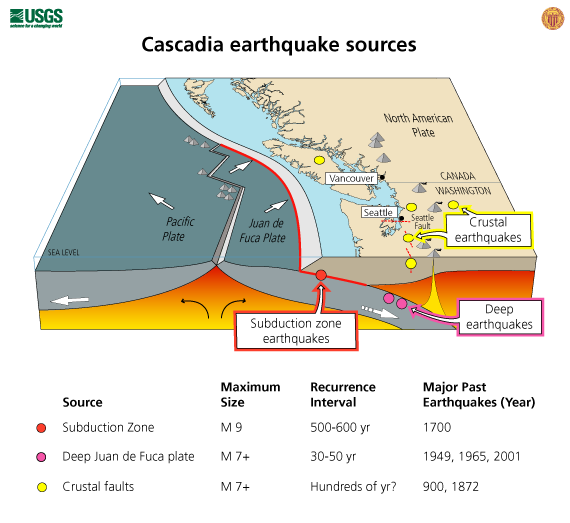
The Cascadia Subduction Zone, where the Juan de Fuca plate is sliding eastward underneath the much larger North American plate, wasn’t discovered until ocean floor mapping became more widespread in the late 1960s. Still, researchers weren’t too concerned following its discovery. “There was a recognition that there was a subduction zone there, but the thought was that it was dormant or quiet,” Garrison-Laney said.
Levels of concern were low because this fault hasn’t generated any earthquakes in modern historical times, Garrison-Laney said. Other similar subduction zones around the globe, in Japan and Chile for example, have produced earthquakes in modern historical times, but this one? Silence.
In the late 1980’s, UW Earth and Space Sciences Affiliate Professor Brian Atwater, colleague David Yamaguchi and others found evidence that the CSZ was responsible for not just one, but seven earthquakes, Garrison-Laney said. In 1997, they also managed to identify the timing of the most recent quake down to the hour: January 26th, 1700, at 9:00 p.m.
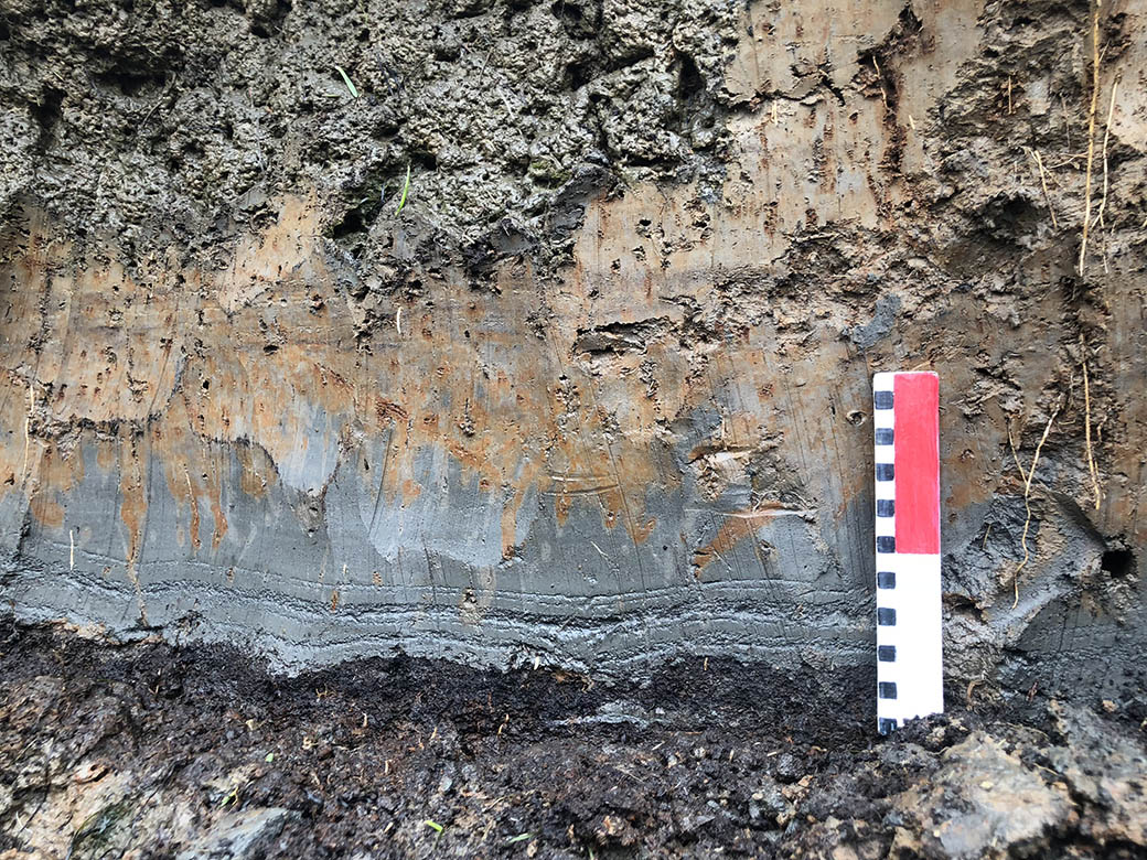
Pinpointing the timing of this earthquake down to the hour, an event that occurred nearly one century before most things were written down in North America, required piecing together a complex puzzle. Earthquake induced avalanches of seafloor mud and coastal tsunami sand deposits told one part of the story. Orphan waves, or waves unassociated with earthquakes, appear in Japanese historical records around the year 1700 — the same year that tree ring analyses by Atwater and Yamaguchi pointed to sudden deaths of “ghost trees” along the West Coast as the land they stood on quickly subsided multiple meters into saltwater below. Pacific Northwest Native Americans have passed down stories of shaking and flooding over multiple generations, further corroborating other evidence. Tsunami models limited the source of these waves to just one area of the globe: the CSZ. For a more detailed and complete explanation of the remarkable efforts that went into identifying the timing of the most recent Cascadia Quake, read The Orphan Tsunami of 1700: Japanese Clues to a Parent Earthquake in 1700.
A tsunami resulting from a subduction zone quake could be immensely powerful and devastating to the Pacific coastal communities. However, while a tsunami from a Cascadia quake would definitely reach Seattle, Garrison-Laney said, the wave would not be nearly as big as it would be on the coast, although currents would still be strong. Additionally, a Cascadia tsunami wouldn’t reach coastal communities for 15-20 minutes, giving people more time to get to higher ground.
The Seattle fault zone
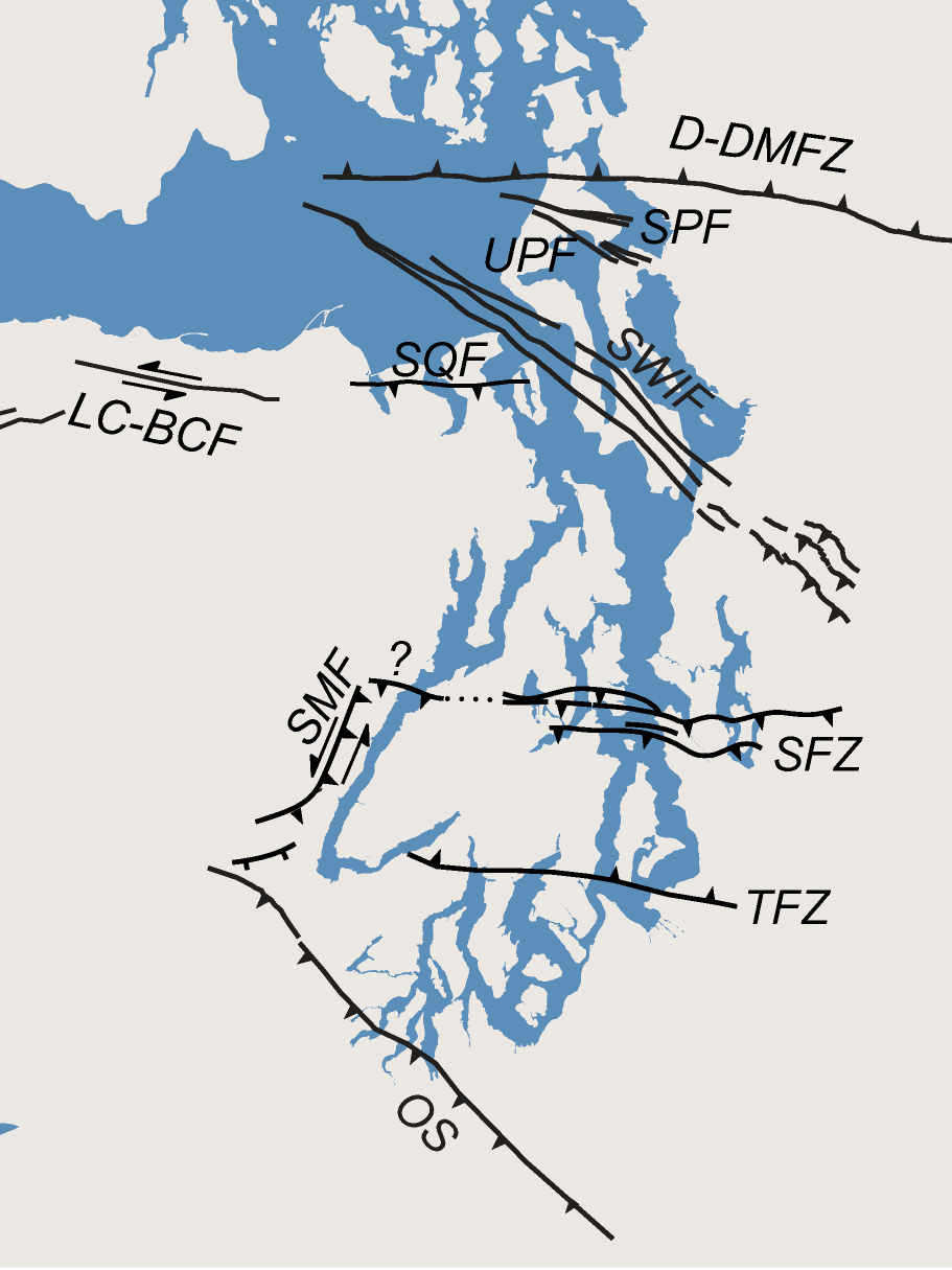
Far more concerning to the Seattle area, but much less likely to occur anytime soon, would be a tsunami resulting from an earthquake in the Seattle Fault Zone (SFZ). This fault zone passes East to West underneath the city, and would bring massive waves into the densely packed city, and much more quickly following the earthquake shakes. A tsunami from an SFZ earthquake could give people only 1-2 minutes to get to higher ground.
Evidence of one of these earthquakes happening 1100 years ago exists, Garrison-Laney said, and if the exact same scenario were to play out today the resultant tsunami would be just one small component of a much larger disaster. Fortunately, the chance of an identical event occurring in the near future is significantly lower, a function of the longer timescale between crustal quakes, and the multitude of different cracks and lines that make up the Seattle fault lowering the chances of an identical quake.
“It would be a really big disaster if that happens again like it happened before,” Garrison-Laney said. But, the way the SFZ runs through the city, makes it possible for the quake to originate in a bunch of different spots, so “there’s no guarantee that the next time there’s an earthquake it’ll unfold the same way. But that’s kind of what we have to work with.”
Deep quakes and landslides

Much more common are tsunamis generated from landslides, but the levels of devastation from these tsunamis can vary widely depending on where and when they occur. Landslides can be generated by earthquakes that happen deep in the Juan De Fuca plate, and Washington has seen several landslide generated tsunamis in the state over the past 100 years, Garrison-Laney said.
Preparation and awareness
In any tsunami scenario, seek higher ground immediately. Several resources exist that can be used to maximize the amount of time you have to respond, including an earthquake early warning system called ShakeAlert, emergency phone alerts, and Twitter notifications from earthquake and tsunami alert accounts.
Twitter, Garrison-Laney said, is actually one of the best resources for timely natural disaster alerts. If you have a Twitter account, you can follow and get notifications from an experimental National Weather Service tsunami warning account.
You can look up if the areas that you spend the most time in are within hazard or inundation zones online via the Washington State Department of Natural Resources. Washington Sea Grant also has several resources available to the public for raising tsunami awareness, including this tsunami hazard overview made by Garrison-Laney for Washington Sea Grant.
Garrison-Laney recommends additional preparation: “If I lived in a tsunami inundation zone, I would definitely have a go-bag with me, and I’d have one in my car and in my house,” she said.
Personalized go-bags can include food, water filters, flashlights and batteries, medicine, warm clothes and more. In the event of a major earthquake in the Seattle area, power could be out for months, and clean water could be hard to find, meaning go-bags could prepare you for the aftermath.
It’s also smart to leave a flashlight and a pair of shoes next to your bed at night, Garrison-Laney said. Tsunami generating earthquakes will scatter glass shards everywhere, and can happen day or night, so foot protection and light could be the difference between making it to higher ground in time or not.