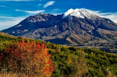
The reason for the location of Mount St. Helens is an enigma. The volcano lies farther west than other peaks in the Cascades volcanic arc. Research published this week may begin to explain why. The last major eruption of Mount St. Helens, about 50 miles northeast of Portland, was in 1980. The mountain spewed steam and ash in 2004, and has since been rebuilding a new lava dome.
The study was led by scientists at the University of New Mexico with co-authors at the University of Washington, Rice University and Cornell University. All are part of an ambitious effort to use remote sensing to better understand the hidden passageways beneath one of the country’s most dangerous active volcanoes. The UW Environment co-authors are Ken Creager and John Vidale, both professors in the Department of Earth & Space Sciences. Other co-authors are Brandon Schmandt at the University of New Mexico, Alan Levander at Rice University, Eric Kiser at the University of Arizona and Geoff Abers at Cornell University.
The paper, published Nov. 1 in Nature Communications, analyzes compressional waves traveling through the crust and reflecting off the mantle below the volcano. Results show that on one side the mantle is largely serpentinite, a rare, moisture-absorbing, dark-green mineral that can look like a snake’s skin. But the mantle below the eastern half of the mountain is mostly olivine, a common mineral that allows water — thought to play a key role in volcanic eruptions — to percolate up and into the overlying crust.
Read more at UW Today »
